[This is an edited version of an article first published in the November 2025 issue of The Messenger magazine as “Turnpikes, Tollgates and Terrible Roads ]
This article looks at the problems faced in maintaining the local road system during the 18th and 19th centuries and the establishment of the Turnpike Trust that managed the roads running through Dallington.
(Note Woods Corner was then still known as Hood’s Corner)
From the 16th century, parishes were required by statute to maintain their roads and were empowered to levy a maximum of six days free labour from their residents.
At a time when most wheeled vehicles were light farm carts and their journeys local, this was adequate. But growing trade brought heavier traffic on main highways, and the subsequent deterioration required more work than this limited ‘statute labour’ could provide.
The Sussex Weald with its heavy clays was particularly susceptible to problems, with heavy loads such as tree trunks needing frosty or dry weather to avoid getting bogged down. Daniel Defoe reported timber taking over two years to travel from Sussex to Chatham Dockyard.
A variety of property taxes were introduced over the next century – in particular, the Highway Act of 1692 established a charge of up to six pence for every pound of annual income from land and property for road maintenance.
However, parishes and landowners increasingly resented having to invest in necessary improvements or to pay for damage caused mainly by non-residents passing through their villages.
The eventual solution was the establishment of organisations known as Turnpike Trusts, authorised by Acts of Parliament to build, maintain and operate stretches of road controlled by toll gates through which certain kinds of traffic could not pass without payment. ‘Turnpike’ originally referred to the barrier at the toll gates, but eventually came to mean the road itself.
Trusts were locally managed and financed by levying charges on road users and issuing bonds mortgaged on these tolls. Running through Dallington and neighbouring villages, the “Beech Down, Battle and Heathfield Trust” was established in 1813 to join Heathfield to Battle, passing through Cade Street, Woods Corner (then known as Hoods Corner) and Netherfield before joining the Ringmer and Battle Turnpike just west of Battle. Another leg ran from Woods Corner through Brightling to Robertsbridge. The new turnpike road was fifteen and a half miles long and was financed by a mortgage of £4,550 on which an interest of 5% was payable to the holders. The finance came from local landowners, including Francis Newberry of Heathfield Park, Jack Fuller of Brightling and the Earl of Ashburnham.
Meetings of the Trustees were usually held at the Swan Inn beside the Hoods Corner Toll, and the Trust was sometimes known by that name. In 1813 they received a Surveyor’s report and agreed the route and necessary amendments to the existing road. James Putland submitted the lowest tender (£210 per mile) and was authorised to build the Road according to the line agreed. In July 1814, satisfactory completion was reported and it was resolved that he be paid his bill of £3,303:11s 111/2d and that the Road now be taken into the Trustees’ own hands.
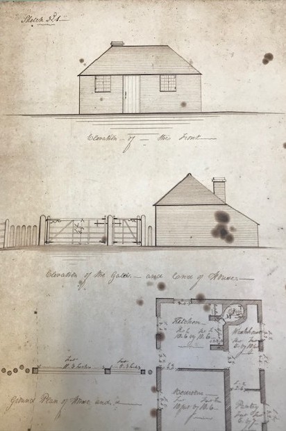
Meanwhile bids were invited to build the toll houses & gates, located at Cade Street, Woods Corner, Netherfield and Robertsbridge. The Keep holds several tenders and detailed plans; the contract was awarded to James Lansdell of Battle who submitted the lowest tender for £406 15s 6d for the work.
Contrary to the original expectations, the income from tolls was never enough to pay down the debt or even to cover the cost of repairs and maintenance, as testified by the several documents in The Keep from parishes requesting money from the Trust to reimburse the cost of additional repairs.
Brian Austen notes that a parliamentary report in 1840 found that although “the greater part is in good condition, having a hard surface of stone or cinders” there were also “parts of which the surface has not yet been hardened”. The final comment was that “it is a cross country road, with but little traffic”.
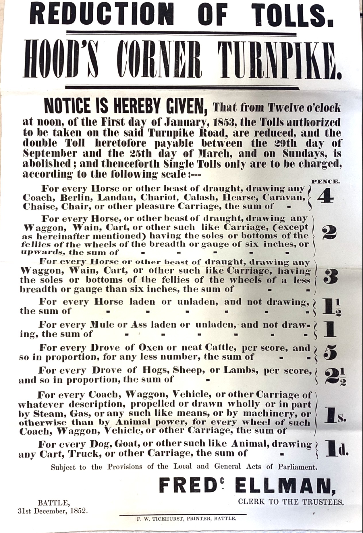
As the poster at the head of the page shows, toll charges were complicated, designed to reflect the damage each traveller inflicted and based on the number and types of beasts drawing each vehicle, and the number and size of the wheels. Initially, tolls were doubled during the winter months and there were various exemptions and reductions for local residents.
The total toll revenue in 1850 was only £254 3s 1d and by this date the total debt had reached £12,676 13s 3d. Toll income was just over 2% of the debt total and it was calculated that if toll revenue was solely employed to pay off the debt it would take nearly 50 years to achieve complete payment.
Given these statistics it is surprising to read in the Sussex Agricultural Express of 24th January 1838 about a very substantial robbery in Dallington. One has to wonder whether the figure quoted was an exaggeration. .
“On Wednesday night last, Cooper the gate keeper at Woods Corner, while in his bed, was surprised by the forcible entrance of two villains, who directly seized him and thrust a silk handkerchief into his mouth to prevent him giving alarm and afterwards bound him down to his bed. The ruffians then purloined his money, amounting to nearly £300 [approximately £40,000 today] with which they got clear off. The poor fellow remained in this unpleasant situation nearly three hours before he was released.”
Every trust was dependent on an Act of Parliament with a limited time span, and each local Act then had to be renewed via a Continuance Act. When the Act of Parliament was renewed in 1852, charges were simplified and reduced as the Schedule of Charges above shows
Despite their previous grumblings, local parishes still wanted to retain the turnpike system rather than take on all the responsibility themselves.
In the 1870s, when many trusts were being wound up under General Acts of Parliament, the parishes of Brightling and Dallington both petitioned Parliament to retain theirs.
Brightling argued that their portion of the road was now “a feeder to the South Eastern Railway Station at Robertsbridge and has much heavy traffic in Hop poles, Timber and other products of the Woodland country of the Weald”.
The Dallington petition also stressed the increase in traffic, and the fact that the Turnpike Road was “managed by Trustees resident in the neighbourhood in an economical manner and at less expense than other roads in the parish… that if the Road shall be thrown on the Parishes, the Gentlemen and others resident in the neighbourhood as well as the public generally, will be seriously inconvenienced .. and the whole expense will fall upon the ratepayers, already heavily rated, instead of those using the Road, thereby increasing the Rates in the Parish of Dallington to about 7/- in the £…. [We] therefore humbly pray that your honourable House will be pleased to [enable] the local act …to be continued”
Nevertheless the Trust was wound up in 1874, and the Earl of Ashburnham purchased the Netherfield and Woods Corner Tolls for £50. Both toll houses were demolished, the latter to improve road accessibility as it was situated in the middle of the road at the top of South Lane (though perhaps modern day villagers might now welcome a building there to slow down the cars speeding through the Woods Corner crossing).
“The transfer of resources and sale of assets to repay loans were supervised by the Local Government Board Toll-houses were sold, gates torn down and responsibility for the main roads passed to Highway Boards. Bond-holders were paid off with any residual funds, though some did not get a satisfactory return on their investment…” (Rosevear )
Under the Highways Act of 1878 all dis-turnpiked roads became “Main Roads” as did some ordinary highways, and by the Local Government Act of 1888 the entire maintenance of main roads was thrown upon the County Councils – where it remains.
However, for many years villages also had their own roadmen, responsible for a particular stretch of road, known as a ‘length’. Their duties included cutting the verges with a scythe or a swap-hook, edging the verges with a spade, sweeping the roads and keeping the ditches clear.
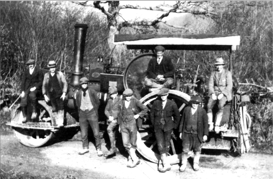
(Photograph from K.Bryant-Mole ‘Six Miles from Everywhere’)
Sources & Further Reading
This account draws on original documents held at The Keep, (East Sussex Records Office) along with three detailed articles available online from the Battle and District Historical Society at https://battlehistorysociety.com/bdarkred/ :
- George Kiloh (2018) Roads in the Battle District
- Peter Miles (2015) ‘The London Road: The Biography of a Superhighway (2015)
- E.J Upton 1971 Turnpikes: The Gates and Toll Houses in and around Battle
Other recommended sources include:
- Brian Austen ‘Turnpikes to Battle and Hastings’ Sussex Industrial History No. 46 2016 available online at https://www.sussexias.co.uk/wp/wp-content/uploads/2024/03/46-2016.pdf
- Dan Bogart The Turnpike Roads of England and Wales available online at https://www.campop.geog.cam.ac.uk/research/projects/transport/onlineatlas/britishturnpiketrusts.pdf
- Alan Rosevear, Turnpike Roads in England available online at http://www.turnpikes.org.uk/The%20Turnpike%20Roads.htm
