This section will be used to collate information about the history of the houses and other buildings in Dallington. We are just starting a process of listing every building by road, which will eventually be linked to census and other historical information. However, in most census years, house names were non-existent or not specified so the schedules simply list a sequence of households in eg The Street, Woods Corner or South Lane. It is rarely easy to be sure who lived in each house without other sources, so you may also find it helpful to consult the transcribed census returns for each year to find who else lived in each area.
We very much hope that residents will share any information they have found about the history of their own houses. If so, or to post a new query, please use the “Leave a Reply” box on the Queries & Replies page.
Listings by road/area
- The Street & Prinkle Lane
- Stream Hill, Padgham Lane, South Lane
- Carricks Hill to Earls Down
- Glaziers Forge Lane
- Dallington Forest
- Rookery Lane
- Bakers Lane
- Battle Road from top of Carricks Hill through Woods Corner to Giffords
- Brightling Road from Woods Corner to Downgate
- Herrings Lane
- Churches Green
(Please note that the main focus of this site is the current village of Dallington, extending beyond the parish boundary to include the postal boundary. Before the 1880s there were a number of isolated areas outside these boundaries, included in early censuses, but later absorbed into neighbouring parishes and not necessarily detailed on this site. You can see a map showing these areas at https://www.thekeep.info/places/eastsussex/parishesandsettlements/dallington/ )
Maps
You can view the Dallington History Google map below which includes listed and non-listed buildings, which we are gradually linking to their pages on this site.
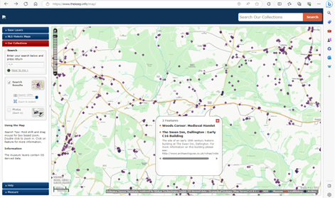
Alternatively, for more detailed historic information, use the interactive historic map on the website of The Keep (home of East Sussex Record Office and many other resources for people researching family or local history) You can access this at https://www.thekeep.info/map/

Hi, I have found your site while researching my 4th Great Grandparents, Joseph and Sarah Bellingham. From the 1841 Census when they were both 70 years old, they were living at Clayton Farm. I have found it on the old maps and can see a house with a swimming pool on Google Maps where I believe the farm was. Does anyone have any old photos of the farm that I can see? TIA
Hello Does anyone know Brookland Cottage Dallington. My distant relative Ebenezer Pound lived there in 1850.
Hi Milly – this is a bit of a puzzle. There were various cottages linked to Brooklands Farm (Brooklands was renamed Carricks Brook a few years ago so you can find that on Google maps) but in the 1851 census, your ancestor Ebenezer Pound wasn’t living there but at the other side of the village at Yew Tree Cottage on the main road between Woods Corner and Battle. (Approx Postcode TN21 9LE) He was also recorded living there in 1841 age 15 with his widowed mother Caroline. By 1861 he was married and living at Woods corner. So not sure when or why he would have been at Brooklands cottage in 1850. Where did this information come from? I tried to see who was living at Brooklands in 1851 but can’t find it right now – not sure if it had a different name then. Will let you know if I find anything else